Computational Intelligence & Remote Sensing ME

São José dos Campos, SP, Brazil
With my experiences and multidisciplinary training, I have been consulted in the areas of technology, geotechnology and remote sensing. With a residence in São José dos Campos, São Paulo, Brazil, the services provided have included sectors ranging from basic education to business, such as larger consultancies with full-stack projects until basic presentations and teaching. Besides, the technologies facilities available today, has changed the way how old problems could be solved, with simpler and more flexible solutions, specially on remote sensing. In this sense, the consultancy also addresses solutions and advice on SaaS (Software as Service) and IaaS (Infrastructure as Service), such as Amazon AWS and Cloud Software Services.
Follow LCIARS page on Linkedin
Specialties
- Image Processing: softwares for detections, statistic analysis, segmentations, classifications, among others involve aerial imagery, including structural datasets (LiDAR and MVS point clouds)
- Scientific image-art: production of images for scientific documents
- Tutorials and teaching (programming): LaTeX (document production), Python, Java, Programming Logic, best practices in programming, so on
- Photogrammetry and Remote Sensing (softwares/IDEs): PhotoScan, LAStools, ENVI, ArcGIS, QGIS, GDAL, CGAL, PCL, MATLAB, so on
Contact
For contacting and an estimate, please, describe your problem/issue/need to rodolfo.lotte@gmail.com, in three lines paragraph, listing the situation and what you exactly need at the end.
Consultancies in progress
Consultancies completed
Computer Vision Research Engineer - ( Jun. 2023 - Ago. 2023 )
ALTAVE - Intelligent Monitoring, São José dos Campos, SP, Brazil
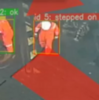
Assist and develop full applications onboard industrial boats/ships where fabricated cameras can be installed and monitor the conditions of workers in these scenarios. In this way, contribute to a well planned workflow in Machine Learning to discriminate the mandatory use of so called Individual Proctection Equipaments (IPE) by each of the employees. Besides, it allows to track possible dangerous situations and build a well determined risks panorama.
 Intelligent Monitoring: Support dedicated to the Brazilian Federal Police (PF), which is part of the inspection program and the initiation of operations through orbital images of very high resolution. The tasks carried out in this area mainly involve the development of tools for monitoring Brazilian forests in order to preserve them and break the chain of illegal land use, as well as other operations of an environmental nature.
SAR imagery and developer consultant ( Oct. 2022 - present date )
Imaflora/SERVIR-Amazônia, Piracicaba, Brazil/Peru
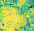
 Instituto de Manejo e Certificação Florestal e Agrícola (Imaflora): Support, implementation and improvement of the RAMI (Radar Mining Monitoring) methodology, an online platform developed by ACCA (Conservação Amazônica) under the SERVIR-Amazônia Program. The RAMI methodology is a geospatial technology tool that provides near real-time monitoring information of the Madre de Dios mining region, using optical and RADAR satellite data. The consultancy involves the application of the respective methodology in the identified mining area in the State of Pará, using feedback from the GIS and ACCA developers. In addition, testing of the methodology based on deep learning algorithms applied to high-resolution open data from the NICFI initiative.
Full-stack Developer - PNUD/UNO ( Jun. 2021 - Sep. 2022 )
PNUD/UNO, Brasilia, DF, Brazil
 National Council of Justice (CNJ): Improvement of the automatic information extraction (Codex) and artificial intelligence (Sinapses) systems of the National Council of Justice (CNJ), working on maintenance tasks and development of improvements for automatic interpretation of processes at the national level. The tasks involve not only changes in the current platforms, but also improvements in performance, infrastructure, unification of SSO authentication systems (Keycloak) and more.
Consultant and Project Manager - ( Mar. 2020 - Jul. 2020 )
Technite Consultoria em Soluções Digitais Ltda, São José dos Campos, SP, Brazil
Use of the Hexagon LuciadLightspeed framework and Lucy Map Centric platform, for the development of a logistics drug control solution. The activities involve the development of a geotechnological solution for the pharmaceutical sector, in order to introduce it to the LUCIADLightSpeed platform, owned by Hexagon Geospatial Brasil.
 Pharmaceutical plataform using Hexagon LUCIAD: Through the Hexagon LUCIAD platform and the LuciadLightSpeed framework, provide the customer with visibility for real-time monitoring of the pharmaceutical sales team, with the objective of obtaining position control, route traveled, visits, definition of sales strategy by region, in addition to identifying and prospecting the target audience not covered by the area in which the team operates. Cross socioeconomic and demographic density data to create visibility of the behavior and characteristics of these areas.
Consultant and Project Manager - ( Jul. 2018 - Oct. 2018 )
Santiago & Cintra Geotecnologias, São Paulo, SP, Brazil
Consultant in Remote Sensing and geotechnologies for detection and classification of patterns over orbital, aerial and terrestrial images. The specialization goes further with the handle of structural datasets, such as LiDAR (Laser Detect and Ranging) and Photogrammetric (MVS images). The main objective of this consultant was to automate a method of detection of deforestation alerts in areas of the Amazon biome, using Phyton, through very high resolution images from Planet constellation (PlanetScope).
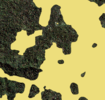 Deforestation: Detect and Classify: The problem in identifying patterns or features in digital images still has many branches. Heterogeneous environments, diverse spectral and spatial variations, often dynamic, among others. Treating as many of these branches (or processing modules) as possible in a detailed and tested way brings even more robustness to the solution. In this work, image processing and pattern recognition techniques (Deep-Learning) were applied for the automatic detection and classification of regions with forest degradation (whether by burning, deforestation or natural disasters).